Description
Product
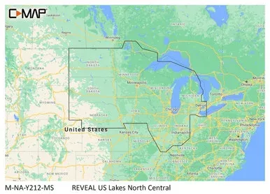
C-MAP Reveal Inland US Lakes North CentralModel: M-NA-Y212-MS
- Shaded Relief
- Full-Featured Vector Charts
- High-Res Bathymetry
- Custom Depth Shading
- Dynamic Raster Charts
- Easy Routing
- Aerial Photos
- Satellite Overlay
- Tides & Currents
- Detailed Marina Port Plans
- Harbor & Approach Details
- Online Updates — including 12 months’ free online updates
- Compatible with Lowrance®, Simrad® & B&G® chartplotters
C-MAP® REVEAL charts display the very best of C-MAP. With Shaded Relief, including game-changing Ultra-High-Res Seafloor Imagery unique to REVEAL, Aerial Photography, Satellite Overlay and Dynamic Raster Chart presentation added to the core C-MAP features found in DISCOVER™Vector charts, including Depth, Contour, Spot Soundings, NavAids, Light Sectors, Wrecks/Obstructions and moreDisplay the highest level of information, setting clear safety depths and identifying underwater pinnacles, ledges and canyons, magnets for coastal game fishHigh resolution detail of nearshore & offshore features such as pinnacles, canyons and ledges helping anglers, includes Genesis® dataAutomatically plots the shortest, safest route based on detailed chart and vessel information.Takes two points and generates a suggested routeDisplays the time, water level and direction of tides with Tide Level graphs and indicates predicted current time, direction and strength. Flow graphs and coloured arrowsRaster charts bring a traditional paper chart look and feelShaded Relief presents the data with a 3D appearance, which is easier to interpret versustraditional contour linesSatellite imagery provides realworld reference, enhances situational awareness for coastalnavigationSpecifications
| Full-Featured Vector Charts | Yes |
| High-Resolution Bathymetry | Yes |
| Custom Depth Shading | Yes |
| Subscription-Free Easy Routing™ | Yes |
| Tides & Currents | Yes |
| Detailed Marina Port Plans | Yes |
| Multilanguage | Yes |
| Marine Protected Areas* | Yes |
| 12 Month’s Free Online Updates | Yes |
| Raster Charts | Yes |
| Aerial Photos* | Yes |
| Satellite Imagery* | Yes |
| Shaded Relief – Standard | Yes |
| Shaded Relief – Standard | Yes |
| * Select Areas |
![Shadow-Caster Courtesy Light w/2′ Lead Wire – 316 SS Cover – Great White – 4-Pack[SCM-CL-GW-SS-4PACK]](https://www.durablemarinebattery.com/wp-content/uploads/2026/08/shadow-caster-courtesy-light-w-2-lead-wire-316-ss-cover-great-white-4-pack-scm-c.webp)
![Ancor Premium Electrical Tape – 3/4″ x 66′ – Orange[334066]](https://www.durablemarinebattery.com/wp-content/uploads/2026/08/ancor-premium-electrical-tape-3-4-x-66-orange-334066.webp)
![Ancor 24-22 Gauge Heat Shrink Step-Down Multi-Wire Connectors – 25-Pack[320025]](https://www.durablemarinebattery.com/wp-content/uploads/2026/08/ancor-24-22-gauge-heat-shrink-step-down-multi-wire-connectors-25-pack-320025.webp)
![Jabsco Mag Drive Centrifugal Pump – 14GPM – 110V AC[436979]](https://www.durablemarinebattery.com/wp-content/uploads/2026/08/jabsco-mag-drive-centrifugal-pump-14gpm-110v-ac-436979.webp)
![Jabsco HotShot HD4 Heavy Duty Washdown Pump – 24V – 4 GPM – 60 PSI [Q402J-118N-3A]](https://www.durablemarinebattery.com/wp-content/uploads/2026/08/jabsco-hotshot-hd4-heavy-duty-washdown-pump-24v-4-gpm-60-psi-q402j-118n-3a.webp)
![Whitecap C.P. Brass Sillcock 1-5/8″ Base 3-3/16 Depth[P-2452C]](https://www.durablemarinebattery.com/wp-content/uploads/2026/08/whitecap-c-p-brass-sillcock-1-5-8-base-3-3-16-depth-p-2452c.webp)